Web-Based Geographic Information System for School Mapping in Cianjur Regency
DOI:
https://doi.org/10.26740/jair.v1i2.49953Keywords:
Geographic Information System, Cianjur Regency, Web-GIS, Mapping School, Google Maps APIAbstract
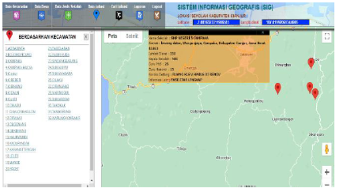
Education requires adequate information infrastructure to ensure equitable access to facilities. Cianjur Regency has a wide and diverse distribution of junior high, senior high, and vocational schools, yet public access to accurate location information remains limited. This study develops a web-based Geographic Information System (Web-GIS) for school mapping in Cianjur Regency using the Waterfall development method. The system integrates spatial and attribute data of 412 junior high schools, 73 senior high schools, and 186 vocational high schools, visualized through the Google Maps API. Functional testing shows that all system features operate correctly, enabling users to access school location information efficiently and accurately. The main contribution of this study lies in the integration of multi-level school distribution data into a single interactive Web-GIS platform to support public access and educational infrastructure analysis.
Downloads
Published
How to Cite
Issue
Section
License
Copyright (c) 2025 Muhammad Chayyun Nadzif Aljazani, Novrindah Alvi

This work is licensed under a Creative Commons Attribution-NonCommercial 4.0 International License.
 Abstract views: 136
,
Abstract views: 136
, PDF Downloads: 178